About Me
I’m a data scientist and machine learning engineer passionate about building intelligent systems that connect data to real-world impact. My work lies at the intersection of spatial analytics, machine learning, and user-centered decision support—transforming messy, complex data into models and tools that drive business and societal value.
I recently completed a Master’s in Urban Analytics at Georgia Tech, where my research focuses on location intelligence, transportation access, and computer vision applications for urban systems. Previously, I led machine learning projects as a Senior Data Scientist at CJ Express and True Digital Group, where I developed solutions ranging from product recommendation systems to geospatial models for customer profiling and infrastructure planning.
Over the past 7+ years, I’ve worked across industries including telecom, retail, and real estate—designing ML pipelines, deploying production models, and mentoring junior teams. I’ve also created interactive data visualizations and visual storytelling projects that make complex insights more intuitive and accessible.
Whether it's optimizing mobility networks, analyzing POI accessibility, or training deep learning models to audit shelf compliance, I’m most excited when solving problems that combine domain complexity with tangible outcomes.
Experience
Machine Learning Scientist Intern · Center for Urban Resilience and Analytics
Develop and deploy a LightGBM-based recommendation system for assistive equipment tailored to elderly users’ accessibility needs, achieving 81% mAP; hosted on an on-premise server for secure, localized accessibility.
Graduate Research Assistant · Georgia Institute of Technology
Design and implement machine learning and geospatial models to analyze infrastructure access and urban mobility. Collaborate with faculty and policy partners on projects involving sidewalk quality detection from imagery and job accessibility modeling across U.S. states.
Senior Data Scientist · CJ Express
Develop end-to-end machine learning solutions for retail optimization. Deployed computer vision models for shelf auditing and built customer segmentation with real-time product recommendations to improve marketing effectiveness and operational efficiency.
Senior Data Scientist · True Digital Group
Data Scientist
Led a team delivering large-scale analytics using telecom and geospatial data. Built a Customer360 dataset from 30M+ users, developed location recommendation models, and created real-time COVID-19 risk dashboards for the Ministry of Public Health.
Data Scientist · Sansiri PLC.
Designed geospatial intelligence tools for land acquisition and urban planning. Developed semantic segmentation models from satellite imagery and dashboards for C-level executives to support data-driven real estate development decisions.
Projects
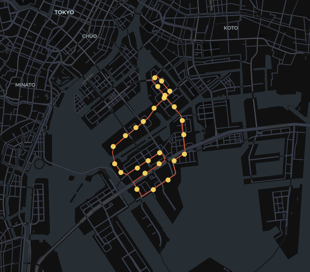
Data-Driven Design of Autonomous Bus System in Tokyo Bay
Analyzed GPS trajectory data and applied clustering to identify trip hotspots. Used TSP optimization to plan routes and semantic segmentation on Google Street View to verify stop suitability in the urban environment.
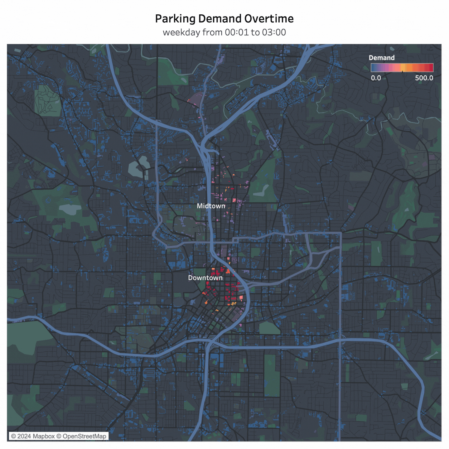
Spatiotemporal Analysis of Parking Demand and Supply Imbalance
Mapped spatial-temporal parking mismatches using the inverse 2SFCA method. Built classification models using satellite and street view imagery to identify parking types (e.g., public vs private, surface vs multi-story).
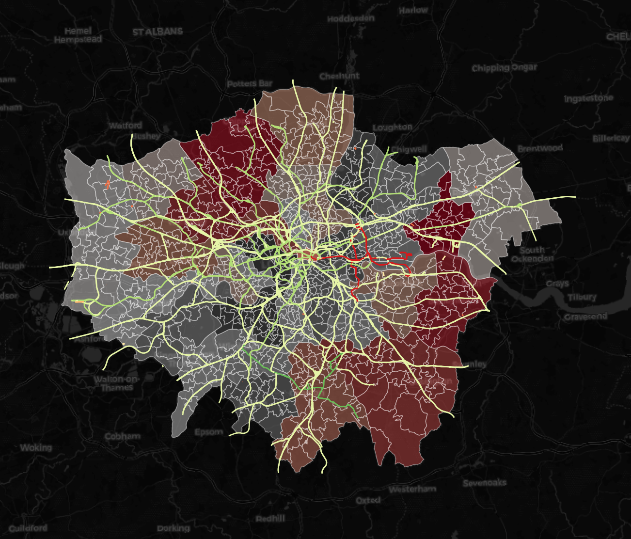
Public Transit Accessibility Analysis (London)
Modeled multimodal accessibility to hospitals and schools across London using GTFS and OSM data. Identified transit access inequities and informed transit planning with dynamic programming and spatial equity analysis.
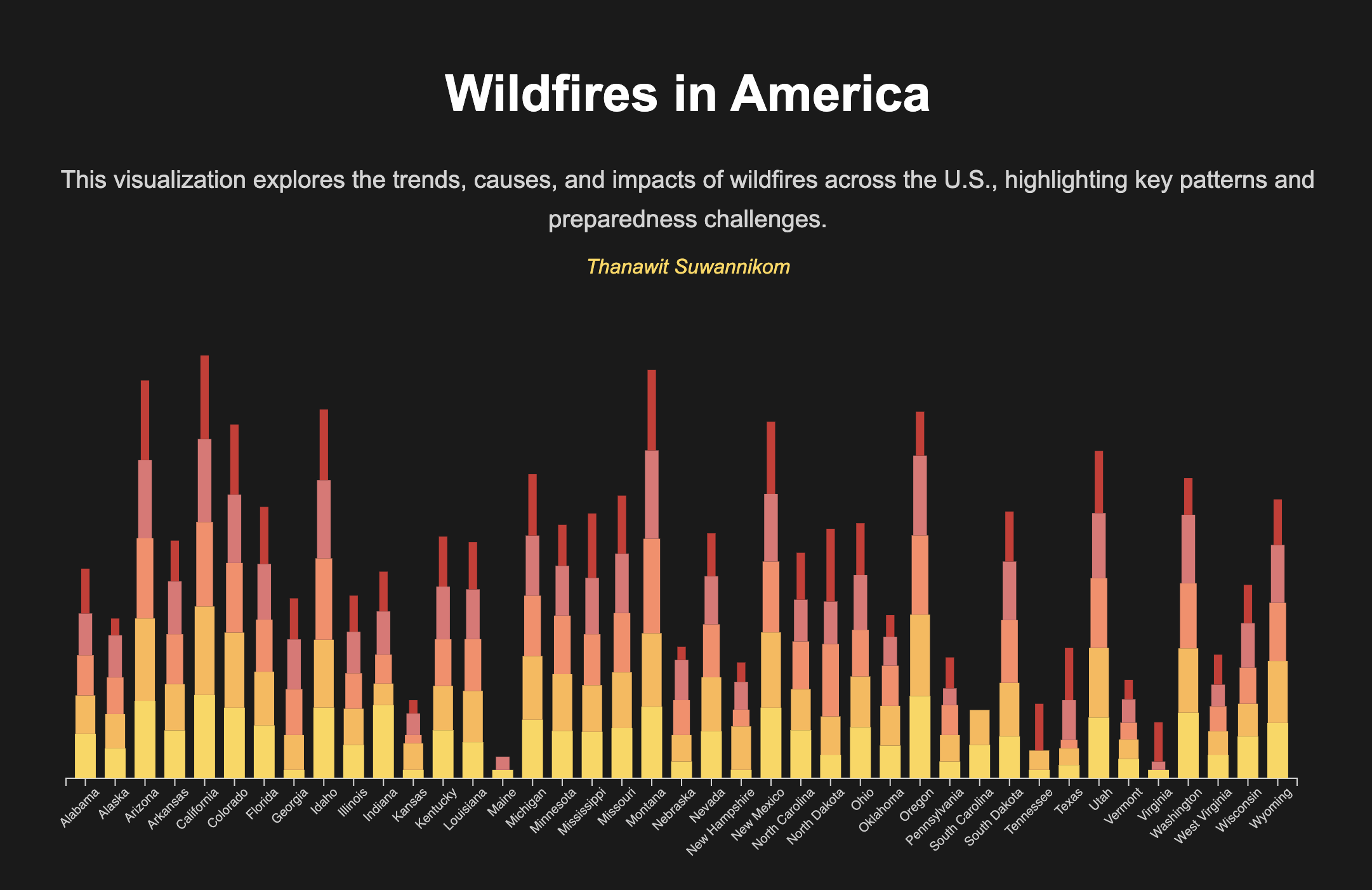
Wildfires in America - Scrollytelling
Developed an interactive, scroll-driven narrative that visualizes the spread and impact of wildfires across the U.S. Utilizing dynamic maps and data visualizations, offering an immersive experience to educate users on the frequency, scale, and consequences of wildfires over time.
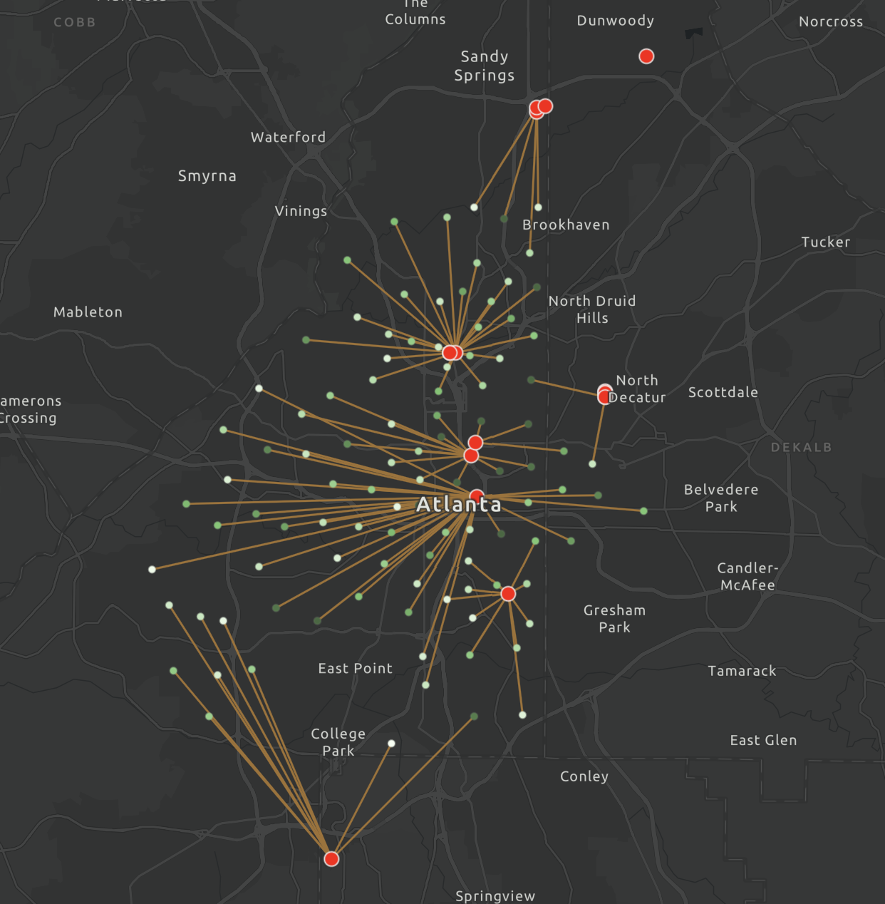
Atlanta Healthcare Accessibility and Network Analysis
Analyzed hospital accessibility and optimizing healthcare facility distribution in Atlanta using GIS and Python.